ESA’s New Satellite Imagery of Madeira Archipelago
The European Space Agency (ESA) has recently unveiled a stunning new satellite image capturing the breathtaking beauty of Madeira Island and Porto Santo. These two gems of the Atlantic, part of the Portuguese archipelago, are showcased in vivid detail, highlighting their unique landscapes and natural splendor. As space technology continues to advance, such imagery not only provides aesthetic pleasure but also offers invaluable insights into the Earth’s geographical and environmental dynamics.
A Glimpse from Space: The Image
The new image from ESA is a product of the Copernicus Sentinel-2 mission, which aims to provide high-resolution imagery for environmental monitoring and various other applications. The satellite’s high-tech sensors have captured Madeira and Porto Santo with exceptional clarity, allowing us to appreciate their distinct features from a new perspective.
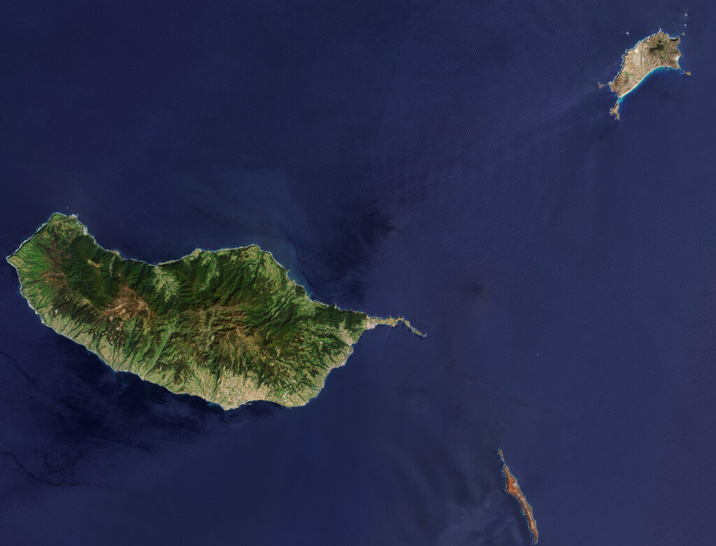
Madeira, often referred to as the “Pearl of the Atlantic,” is renowned for its rugged terrain, lush greenery, and dramatic coastlines. The satellite image reveals the island’s volcanic origins, characterized by steep mountains and deep valleys. The Laurisilva forest, a UNESCO World Heritage site, stands out with its dense, verdant canopy, a testament to Madeira’s rich biodiversity.
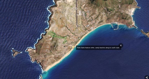
Porto Santo, in contrast, is known for its golden sandy beaches and more arid landscape. The island’s relatively flat terrain and long stretches of beach are clearly visible, providing a stark yet beautiful contrast to the ruggedness of Madeira. This juxtaposition highlights the diverse geographical features within the archipelago.
The Importance of Satellite Imagery
While the aesthetic appeal of such images is undeniable, the significance of satellite imagery extends far beyond beauty. The data captured by missions like Sentinel-2 play a crucial role in various scientific and practical applications:
- Environmental Monitoring: Satellite images help track changes in land use, forest cover, and coastal erosion. This information is vital for conservation efforts and sustainable development planning.
- Disaster Management: High-resolution imagery is essential for monitoring natural disasters such as wildfires, floods, and landslides. It enables rapid response and effective management strategies to mitigate impacts on human populations and infrastructure.
- Climate Research: Observations from space contribute to our understanding of climate change by providing data on temperature fluctuations, sea level rise, and glacial movements.
- Urban Planning: Detailed images assist in urban development, helping planners design cities that harmonize with their natural surroundings while accommodating population growth and economic activities.
Madeira and Porto Santo: A Blend of Natural Wonders
Madeira and Porto Santo, though part of the same archipelago, offer distinct experiences to visitors and researchers alike. Madeira’s towering cliffs and dense forests invite adventurers and nature enthusiasts to explore its hiking trails and diverse ecosystems. The island’s mild climate and fertile soil also support a variety of agricultural activities, including the cultivation of the famous Madeira wine.
Porto Santo, with its serene beaches and clear waters, provides a more relaxed atmosphere. It is a haven for beachgoers and those seeking tranquility away from the hustle and bustle of more tourist-heavy destinations. The island’s simpler landscape is equally important for scientific studies, particularly in understanding coastal dynamics and marine biodiversity.
The Future of Earth Observation
The release of this new image by ESA underscores the continued importance of Earth observation in our quest to understand and protect our planet. As technology evolves, we can expect even more detailed and informative imagery, aiding in the global effort to address environmental challenges and promote sustainable living.
In conclusion, the new satellite imagery of Madeira Island and Porto Santo is more than just a visual delight; it is a window into the intricate and dynamic systems that govern our natural world. Through the lens of space technology, we gain a deeper appreciation for these Atlantic jewels and a greater commitment to their preservation.